This isn’t a volcano trip, but I snuck it in as a little side trip along the way to skiing all the Cascades!
It’s a bit of a geographical quirk that Mt Whitney, the high point in the continental United States, and Badwater Basin, the low point in the continental US, are only separated by about 100 miles. Death Valley and Badwater Basin in particular are formed by mountain ranges that are being pulled apart by tectonic forces, causing the valley floor to slip lower and lower below sea level. The low point is at about 282 feet below sea level while the neighboring peaks continue to rise at a slow pace. The extremely small precipitation in Death Valley contributes to the presence of beautiful colored metamorphic rock formations. The Sierra Nevadas, just a stones throw away, are formed from an entirely different set of rock and are being actively uplifted at a very fast pace (millimeters per year!). Unlike Death Valley, the Sierras were shaped by glaciers and the remaining stone is largely granite, with metamorphic rocks having long ago been swept down into the Owens River Valley below.
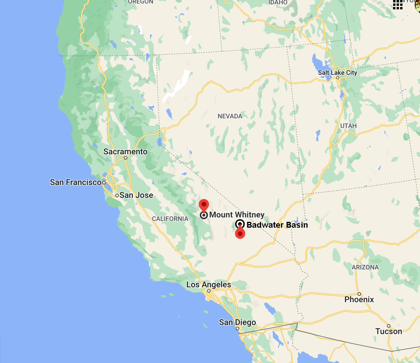
On an adventurous trip a few years ago in (I think) 2019, I went to Death Valley and did a canyoneering descent in the Amargosa Range with Daniel, Alan, and Andrew. The canyon was named Styx Canyon (neighboring canyons include Hades and Cerberus) and drops you dramatically into Death Valley or straight into Hell depending on the time of year that you take the trip. One of the most dramatic parts of that descent was the view of Telescope peak on the far side of Badwater Basin, looming more than 11,000’ above the valley floor. As the canyon twisted downward we kept discussing the idea of coming back some day and climbing Telescope directly.
But when you get to the top of Telescope you run into a different problem, which is that you can see Mt Whitney directly from the peak. This doesn’t have to be a problem, but for a certain kind of person it can really bug you to know that you were just earlier that day at the lowest place in the country and that the highest spot in the country is, well, right over there!
I threw around the idea of this trip, as a concept, and left it at that… until Alan sent me an email in August 2020 to tell me he was trying to organize a hiking trip of the “Low to High”. On foot you have to cover over 130 miles, caching food and water in advance at key points as you cross up and down through the Panamint Range, then the Inyo Range, and finally the Whitney range. The logistical issues with the hiking version of the trip are intimidating, not least that to do the trip in a week (taking five days of vacation) you need to cover nearly 20 miles each day! In late 2021, after starting to plan and then giving up twice on the whole concept, I suggested to Alan an alternate plan in which we biked the middle 90 miles, turning the trip into a sort of pseudo-triathlon: hike from badwater to telescope, bike to whitney portal, and then hike to the summit of whitney.
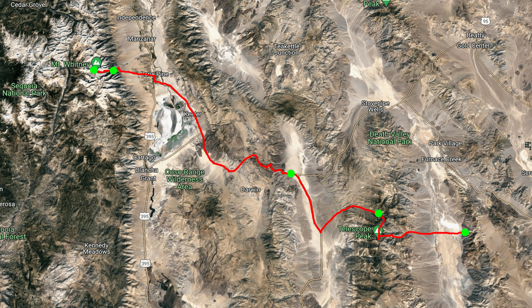
So that was our plan (which required 63 back and forth emails to finally settle on). I marked on the map above our stopping points: day one from badwater basin to the charcoal kilns, then on day two a short bike ride down to the panamint springs resort and a few hours of rest, day three the big bike ride from the panamint valley all the way to the whitney portal, and finally on day four and five the climb of whitney.
In total the adventure would take us up almost 25,000’ of elevation gain, 17,000’ on foot and 8,000’ by bike, as well as a total hiking distance of 36 miles and biking distance of 90 miles.
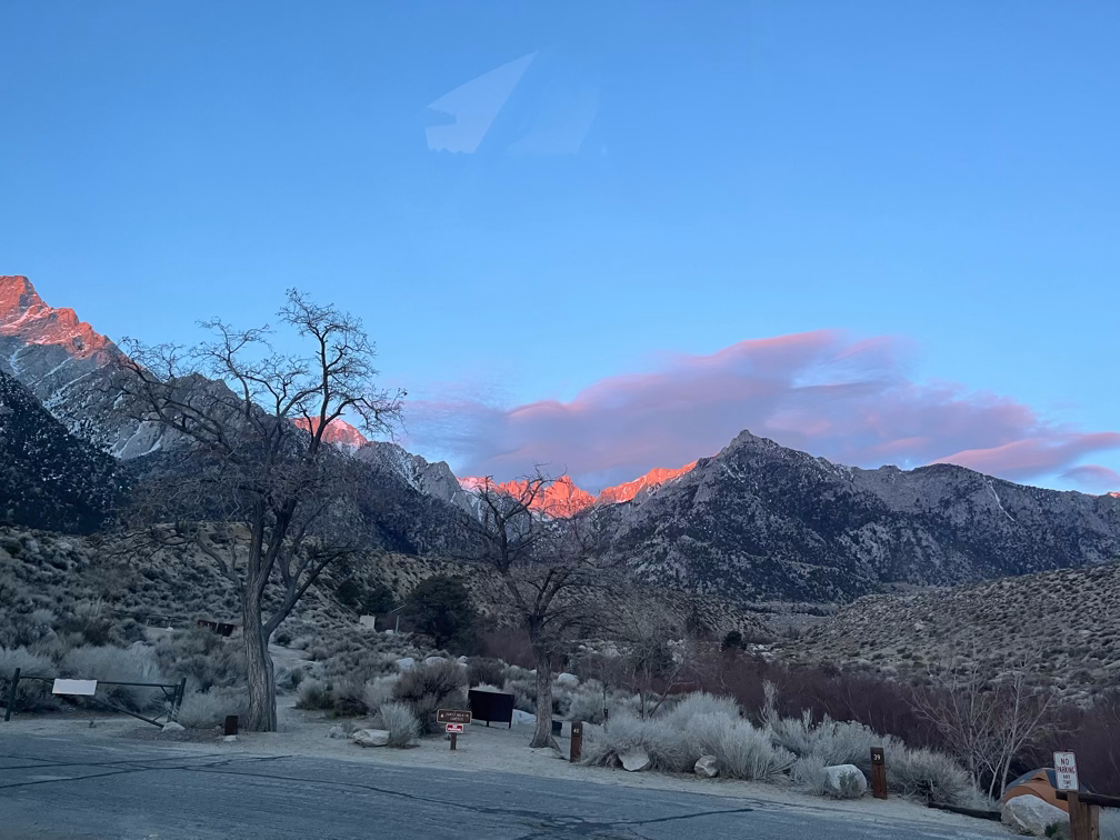
We committed fully to the trip idea in November 2021, trained for four months as well as we could, and then arrived in on the evening of March 12th in Lone Pine, California to start preparing. We camped at the base of Mt Whitney and in the morning, before we began “day zero”, we caught a glimpse of the summit of Whitney in the distance. Luck and preparation permitting, we would be back four days later.