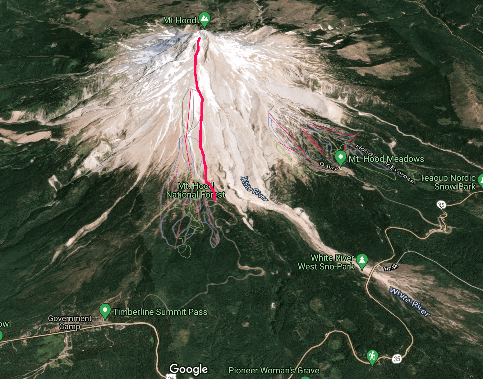
The South Side route on Wy’east is at the same time a big step up and a big step down from the mellow skiing on the Worm Flows route of the previous week. You start at a ski lodge, and the first half of the south side route is just skiing up past the lifts. It’s a bit disheartening to ski for two hours and realize you could have taken a lift the whole way! In total Wy’east is about +5300’ of elevation gain over just 4 miles.
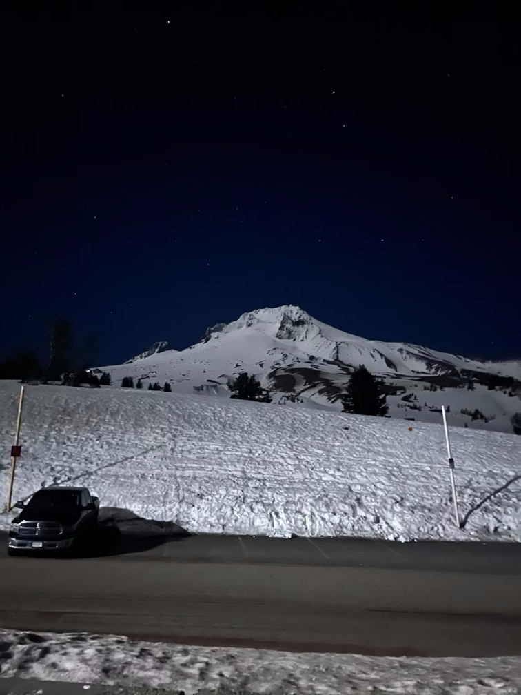
My friend Alex has skied all the volcanoes in Washington state, but he hasn’t done Hood even though it’s just an hour south of the border with Oregon. We took a day off on a Friday and blasted down the night before, spending the night in the parking lot of the ski lodge. With the clear and cold weather we had beautiful views of the mountain.
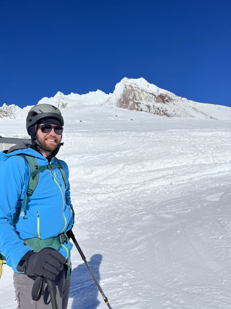
We woke up around 7:00am when people started driving into the parking lot to ski at the actual resort and by 8 or so we were moving up the mountain in a ripping wind! The snow was ice, but the sun was shining and the temperatures were warm which gave us a false sense of hope about the afternoon conditions.
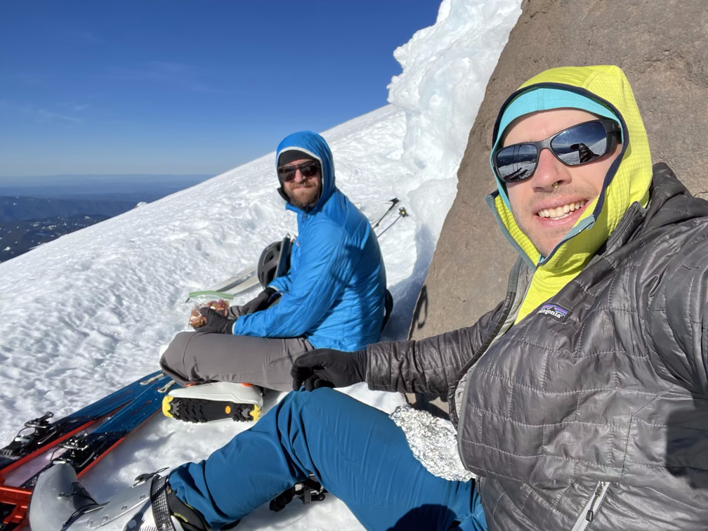
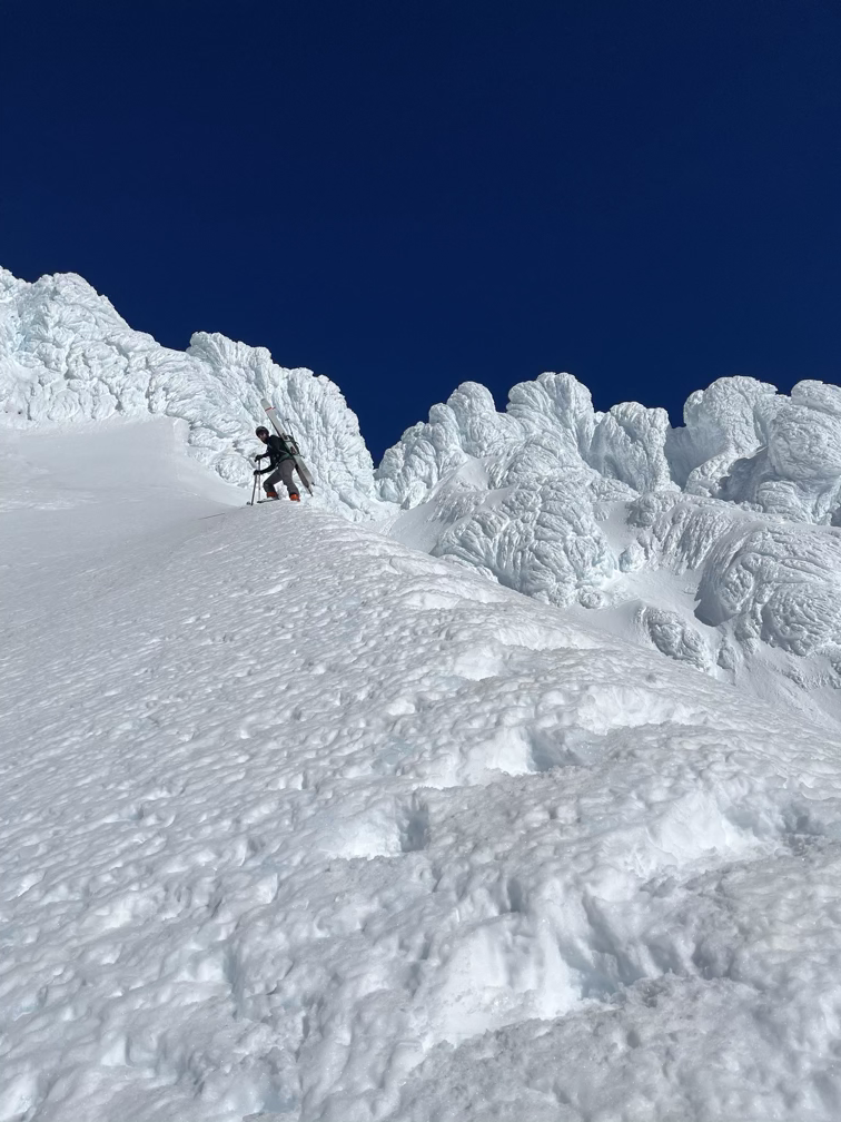
A few boulders sticking out of the snowfield/glacier were great for taking some short breaks behind while we warmed up in the sun. Overall we were pretty optimistic, especially once we got past the top of the lifts.
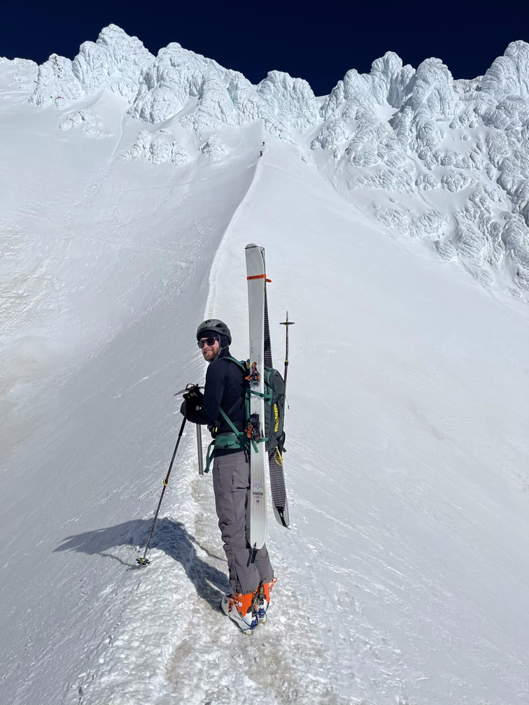
Compared to Lawetlat’la the terrain on Wy’east is a completely different nature. In Winter Lwetlat’la feels like a huge open ski bowl, you can barely tell that you’re on a volcano until you pop out on the summit rim and look down into the massive valley where there used to be a mountain. On Wy’east as soon as you get up past the ski resort lifts you pretty quickly get overwhelmed by the smell of sulfur.
That sulfur smell comes out of the open crater that you pass on the Hogsback, a pretty crazy fin of snow that separates the two halves of the crater itself.
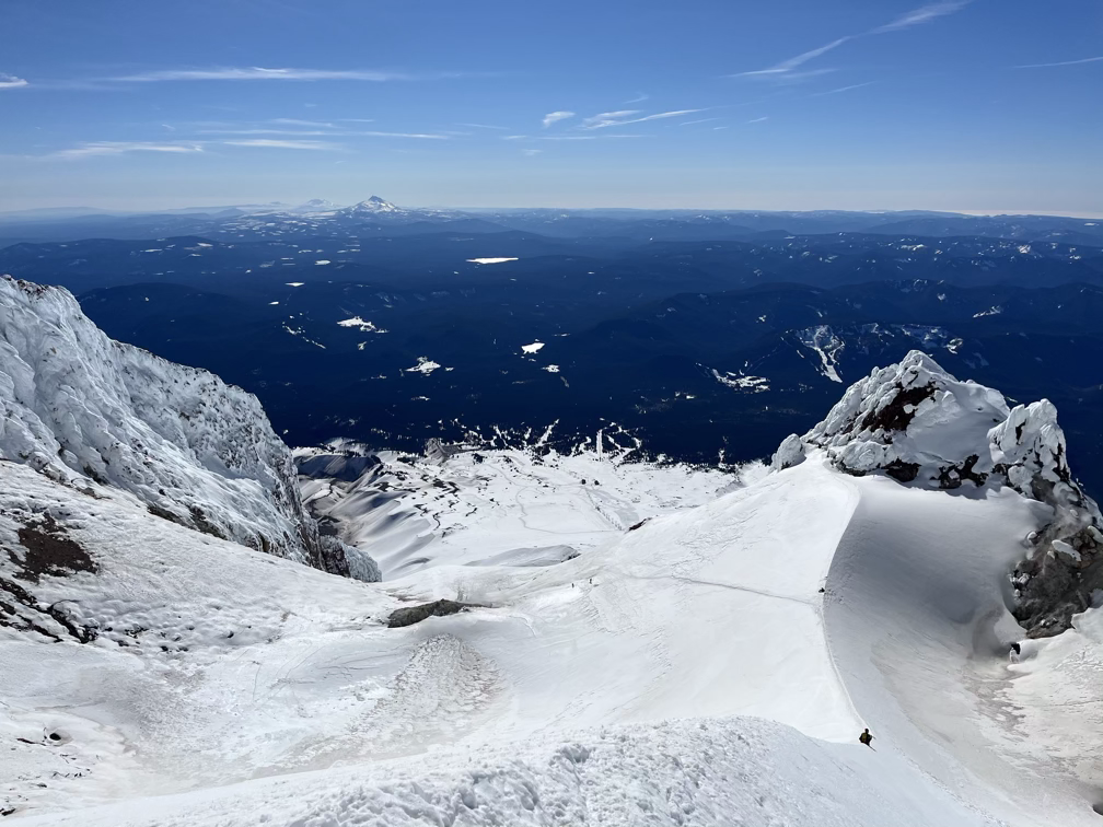
Unfortunately for us, above the Hogsback we got turned around by the conditions in the pearly gates. It’s basically a steep funnel of snow and on the day we were there it was about 2 inches of slush on top of pretty solid ice. We had each brought a single mountaineering ice axe, but we couldn’t get the shaft of the axe to sink into the ice at all, so we were basically just walking on our crampons. Neither of us felt comfortable on the terrain, especially with the big runout going down into the crater below. Next time we come back we’ll have to bring two ice axes each for the extra security. In all likelihood, by the time we get back in spring the ice will have softened up and we’ll have no trouble just walking straight up the chute.
Weirdly, there was no wind at all on the summit, but as soon as we descended back below 10,000’ we started getting blasted again by the 15-20 mph winds we had in the morning. Unfortunately, that wind kept the snow frozen solid, and we basically gave ourselves minor concussions for thirty minutes trying to ski down the sun-cupped ice. Eventually, we made it back to the top of the resort where the runs are kept groomed, still smiling!
After that it was all enjoyable groomers back to the car at the resort. I lost an embarassing two rounds of rock-paper-scissors and took the keys, then drove the car down to the lower part of the resort where I picked Alex up after a 7,000’ descent from (almost) the summit back to the highway! Epic run, even if the snow conditions weren’t the best.
We’ll be back later in the spring when things are a bit warmer to spend some more time on this beautiful mountain!